Thursday, May 28, 2026 |Navi Mumbai
--:-- | --°C | AQI --
If it's not on Unbox Daily HQ, it's not a Launch. Every product, policy and brand launch in India. One hub. What's new?
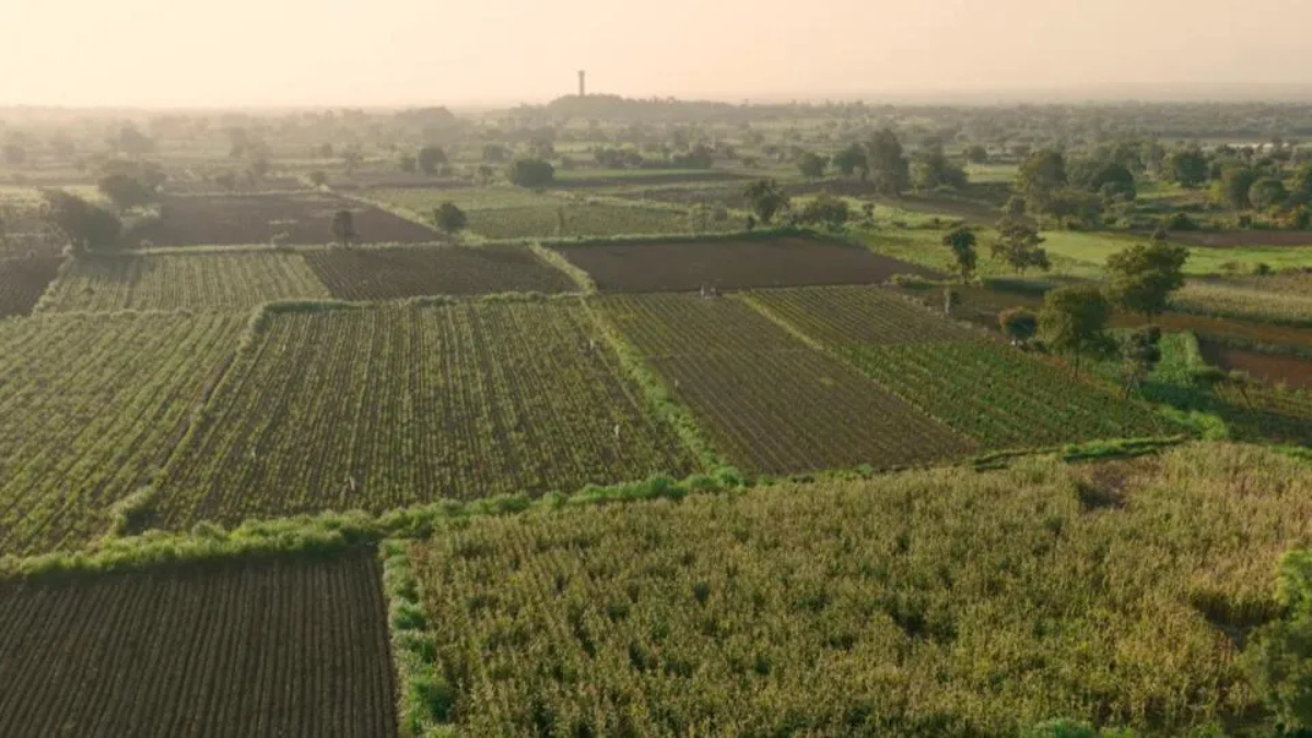
The ALU and AMED models replace physical field surveys with remote satellite data analysis.
The Takeaway
Google DeepMind brings its spatial intelligence tools to a wider global audience. The AnthroKrishi team originally built these systems specifically for India. Now they map massive physical areas remotely. The United Nations Food and Agriculture Organisation is actively integrating the technology into its CROPGRIDS platform to update agricultural statistics faster.
The system splits into two distinct halves. The Agricultural Landscape Understanding (ALU) model draws foundational maps and confirms field boundaries. The Agricultural Monitoring & Event Detection (AMED) model handles dynamic changes like sudden crop stress. Developers plug into the raw APIs for free. Those APIs digest satellite imagery combined with climate signals and localised market data. You can also view the ALU layer directly inside Google Earth right now. It currently ranks as one of the platform’s most popular data layers globally.
Most farm diagnostic systems rely heavily on manual field surveys and paper reporting. These models eliminate the physical visit entirely. By pulling fragmented land records and organising them into one clear picture, third-party platforms can estimate farm revenue or secure biofuel procurement straight from a desk.
Just as turn-by-turn directional tracking arrives on the Google Pixel Tag to locate small personal items, these agricultural models use spatial intelligence to map massive regional zones. Terrastack built a platform on these APIs to connect Indian farmers with formal credit networks. That single setup currently covers over 140 million hectares of cultivated land.
ALU and AMED expansion details
ⓘ Sponsored: Unbox Daily HQ earns a commission if you buy through these links, at no extra cost to you. Prices shown are subject to change, and the actual price on Amazon at the time of purchase may vary from what is displayed here.
| Metric | Confirmed Scale |
| African availability | Kenya, Uganda, Ghana, Rwanda, Nigeria, Zambia |
| Current CarbonFarm footprint | 12 countries |
| Karnataka management area | 2.6 million hectares |
| Telangana beneficiaries | 5 million+ farmers |
This deployment changes how local state governments allocate resources on a daily basis. The Telangana government feeds the datasets straight into its Agriculture Data Exchange. The NaPanta app uses that specific feed to push instant crop warnings to phones. Over in Karnataka, the water resources department plans river basin usage based directly on these remote weather signals. It speeds up bureaucratic efficiency considerably. The carbon tracking initiative led by CarbonFarm ultimately aims to support two million hectares of low-carbon rice by 2030.
The Unboxed Truth
We evaluate a lot of digital infrastructure at Unbox Daily HQ, and this execution actually works. You rarely see complex AI packaged directly into public tools like Google Earth. The ALU and AMED models act as a silent engine for local apps you might already use for pest advisories or credit access. Since the developer access costs nothing, it removes the usual financial barrier for non-profits building climate tools. It is a smart baseline for developers who need spatial intelligence without paying for satellite subscriptions.
Best for: Developers building agricultural advisory apps or credit platforms.
Who Is This For: 25-50 years.
Courtesy: Google DeepMind
The ALU and AMED model APIs are completely free for developers to access. Anyone can also view the foundational ALU layer globally at no cost directly inside Google Earth. In India, third-party platforms deploy these datasets across 140 million hectares of farmland to assist with credit access and water management.
The models replace manual field surveys and paper reporting with automated satellite analysis. They combine remote land records, climate signals, and market data to detect crop stress straight from a desk. In Telangana, state applications use this real-time stream to deliver hyperlocal pest and weather advisories to five million farmers.
Yes, they are worth adopting for software developers building agricultural advisory tools or rural credit platforms. Free API access removes the steep operational costs of purchasing private satellite imagery subscriptions. In India, they provide an immediate foundation to diagnose crop stress and verify farmland data without expensive field teams.